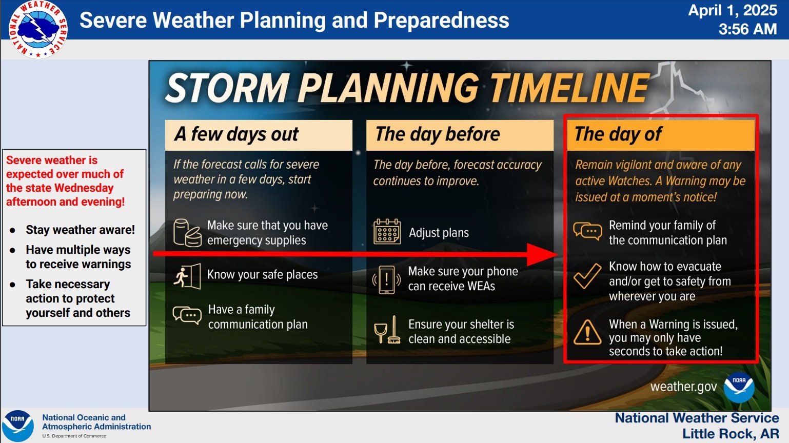
From the National Weather Service in Little Rock….
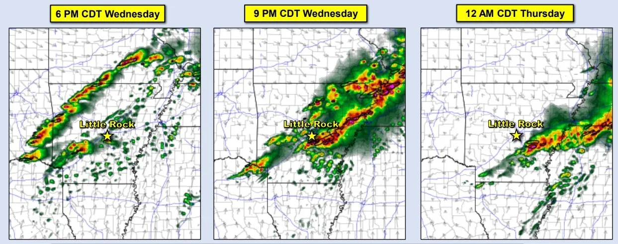
Severe weather and Flooding are expected today with multiple different waves or storms pushing through the state this morning into the evening.
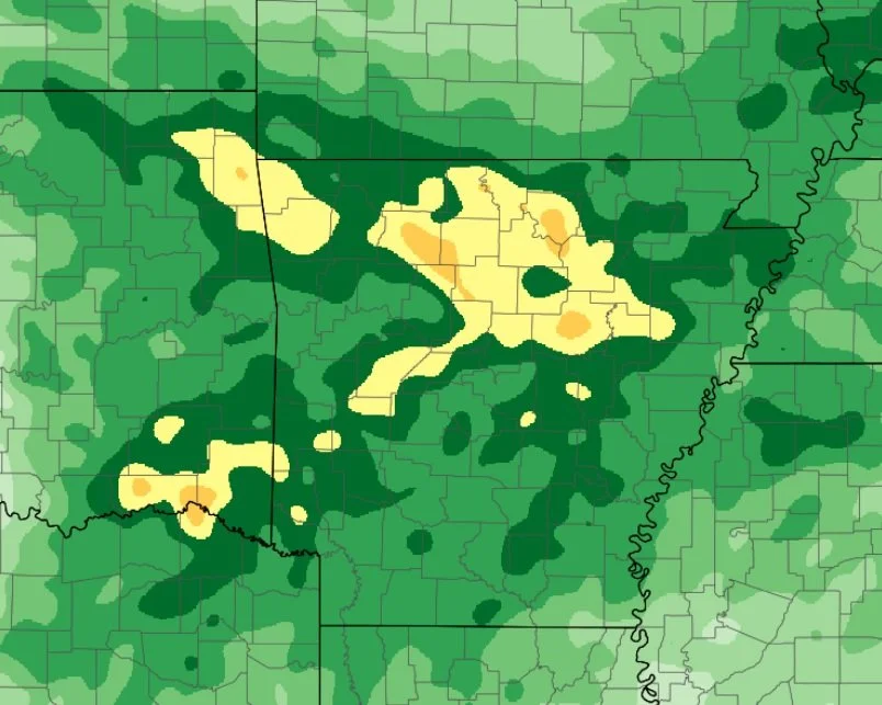
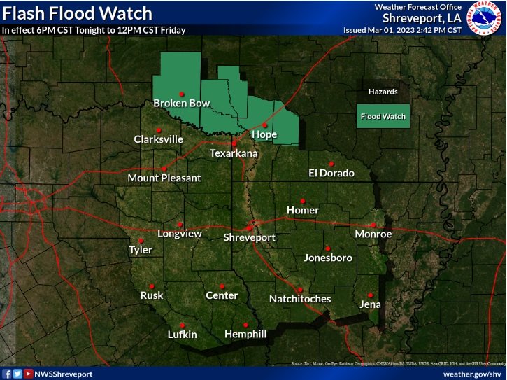
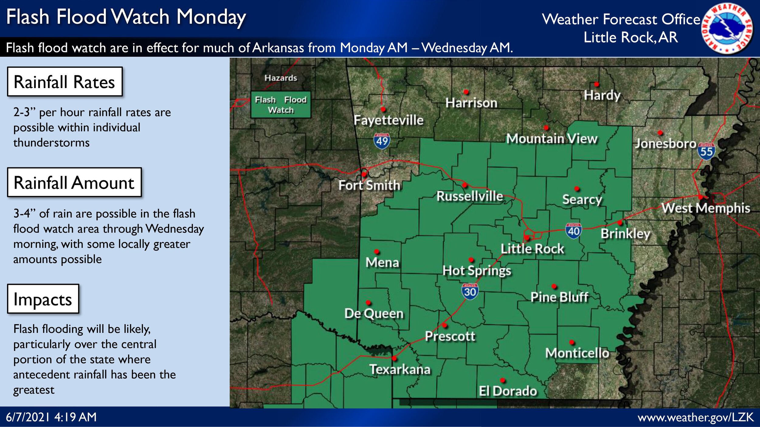
Main threats will be Large Hail (up to 1.75"), Damaging winds (up to 70mph), and Flash Flooding (max 2-3" of rainfall)
An updated briefing with the latest information is attached.

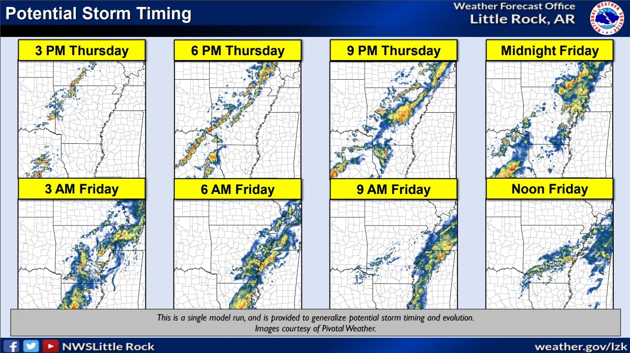
Severe Weather Friday/Heavy Rain Friday Main Threat Summary:
Friday Morning (Severe) / Excessive Rain Friday ○Damaging Winds: Up to 70 mph ○ Large Hail: Up to Golf Ball (1.75”) ○ Tornadoes: Unlikely ○ Flash flooding where storms train over the same locations (I-30/I-40 corridor and south) Trends/Confidence:
Severe thunderstorms potential has increased in the last 24 hours
Expect Severe weather early Friday morning with another round in the afternoon
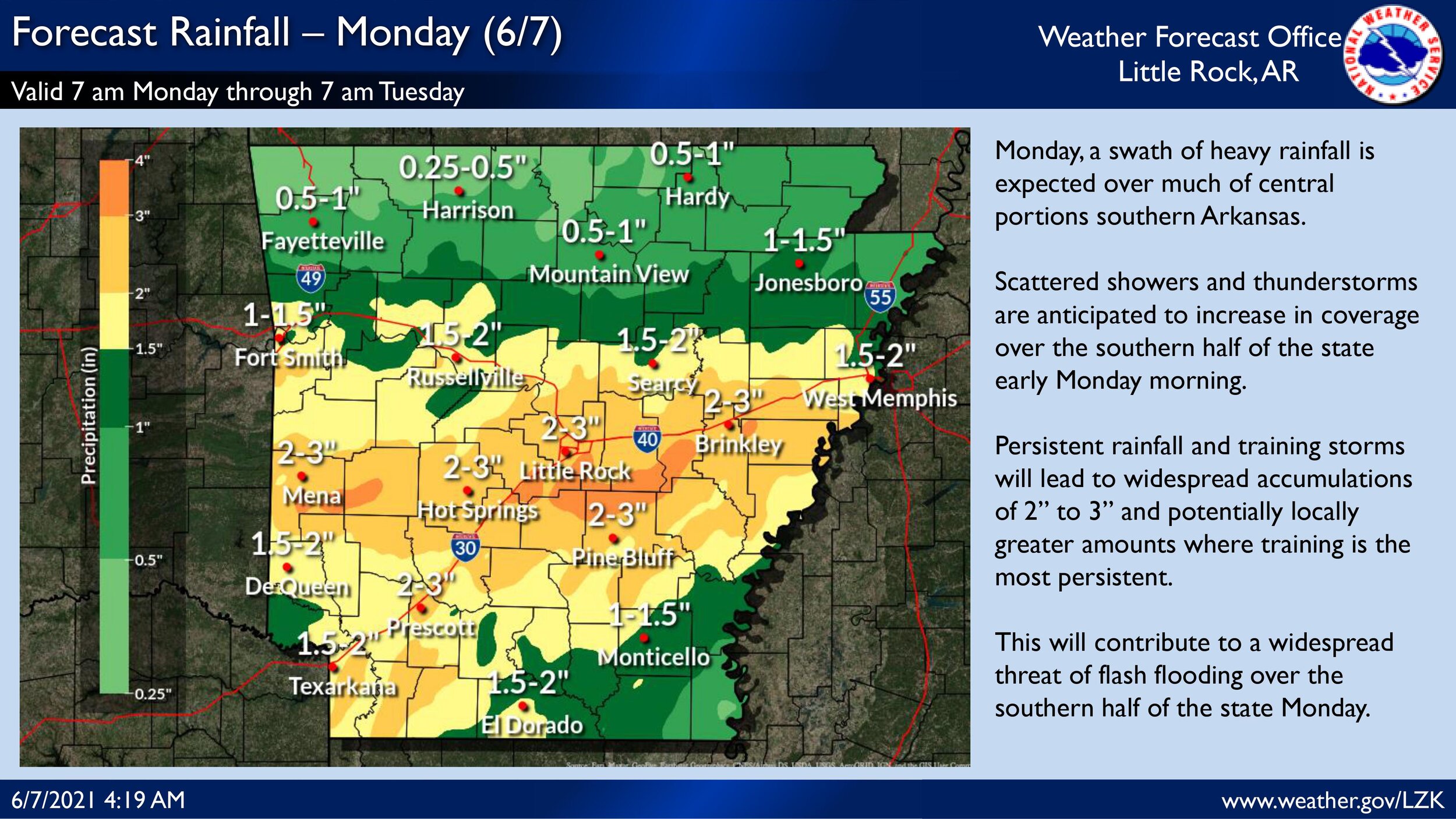
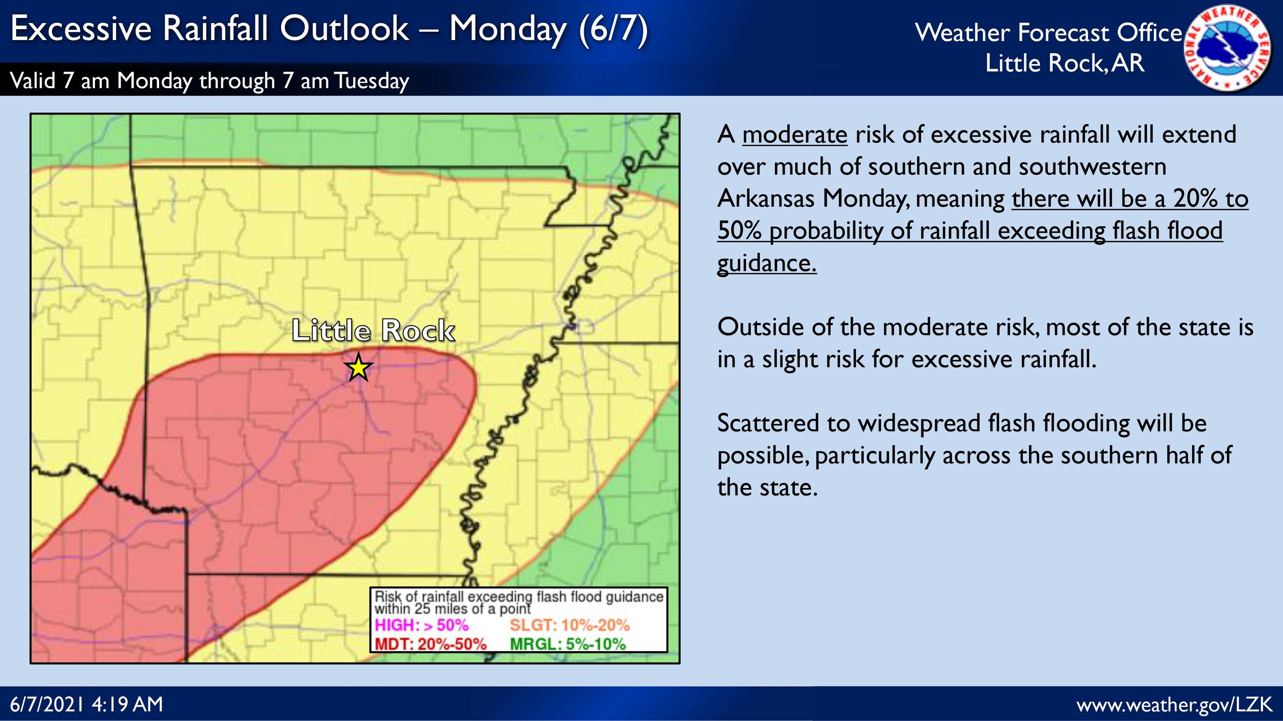
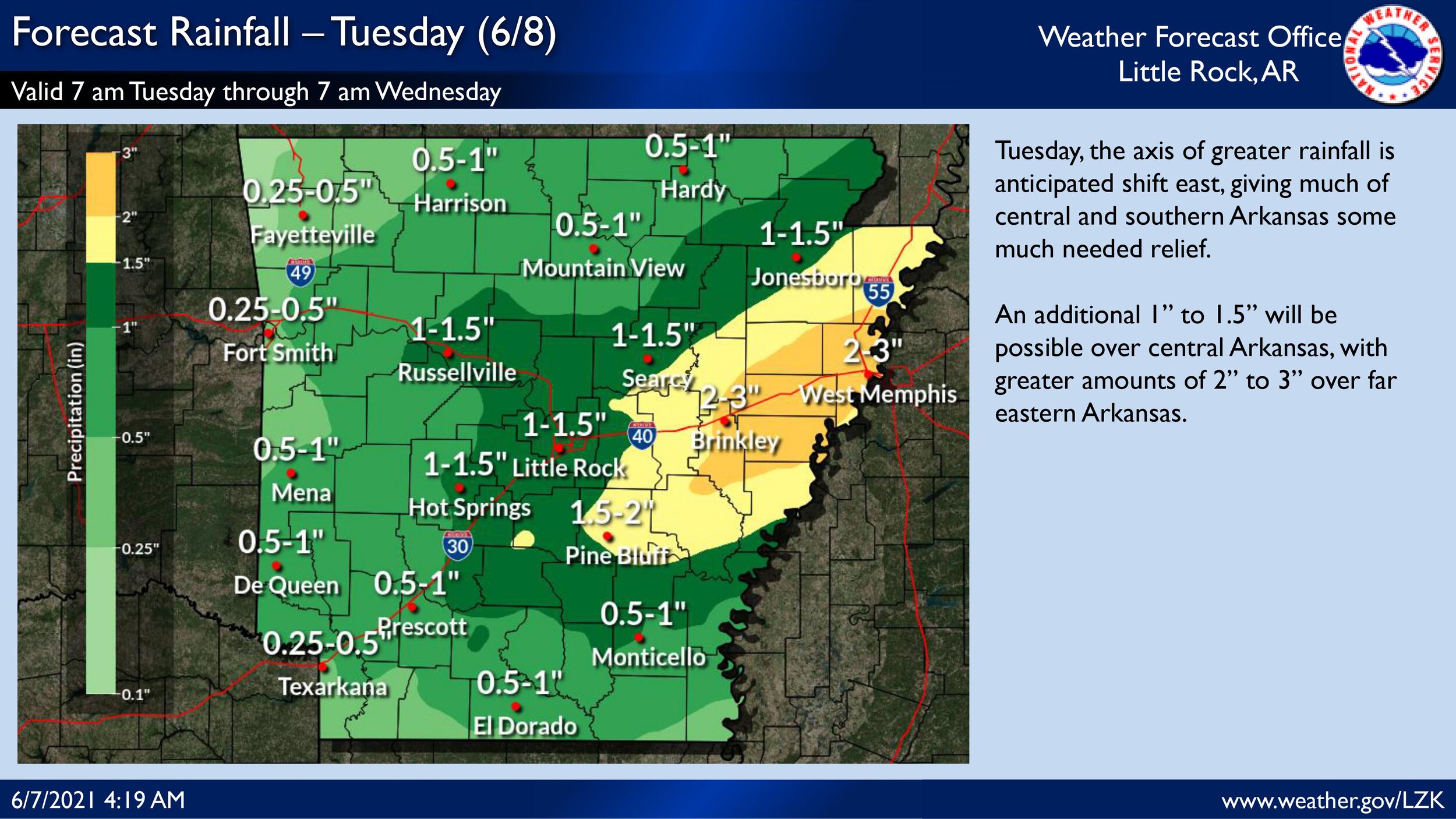
Locally heavy rain can not be ruled out over parts of Arkansas Friday morning through the evening