At least a few rounds of showers and thunderstorms are expected across Arkansas over the next few days. This could provide severe weather and flash flooding to parts of the state.
National Weather Service in Little Rock Morning Crew

TUESDAY
Storm timing: Tuesday afternoon into Tuesday night
Areas impacted: Northern half of Arkansas
Main hazards: Damaging winds up to 60 mph, large hail up to 1.00” (≥10% of significant hail of ≥2” within the hatched area), and a tornado or two is possible over mainly northern half of Arkansas

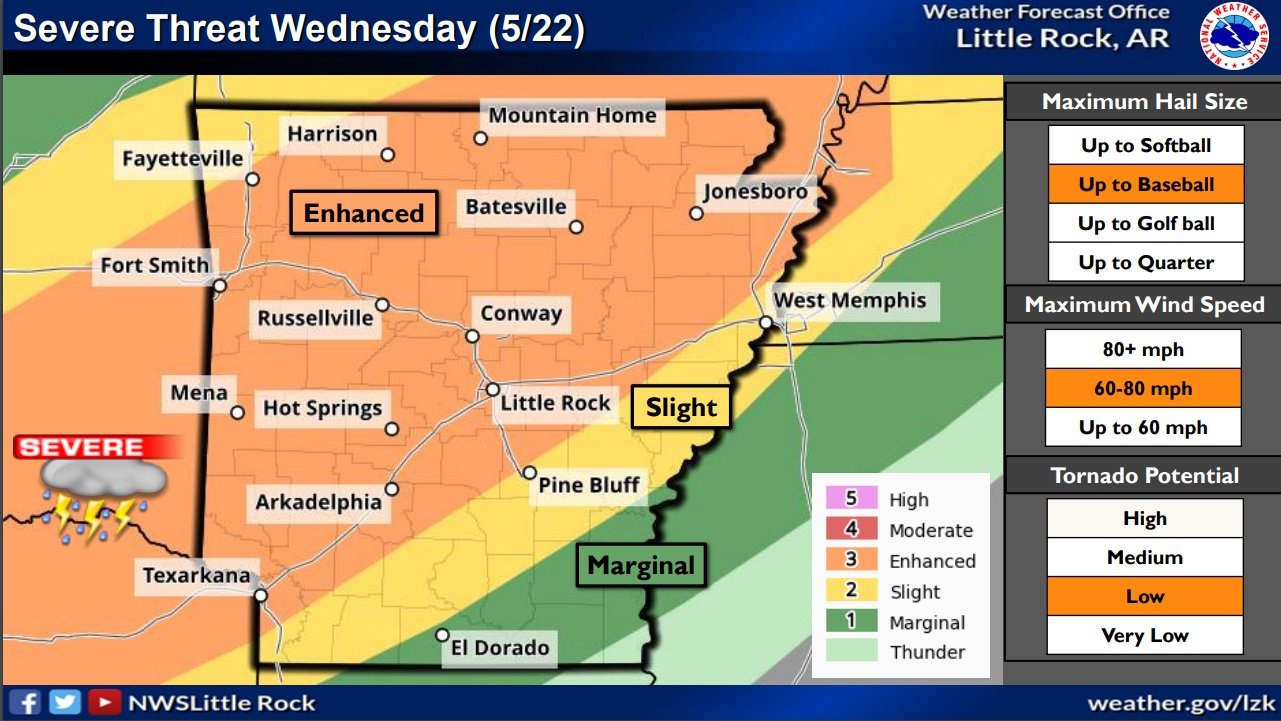
WEDNESDAY
Storm timing: Wednesday afternoon into Wednesday night
Areas impacted: Much of Arkansas, especially the western half of the state
Main hazards: Damaging winds up to 60 mph and a few tornadoes are possible
Secondary hazards: Large hail up to 1.00”
An updated briefing with the latest information is attached below.