Sevier News

News from the UA Cossatot Agriculture Department

UA Cossatot and UA Fayetteville Bumpers College of Agriculture recently signed an articulation agreement for a direct transfer of UAC’s Agriculture Business Program to the Bumpers College at the University of Arkansas Fayetteville. Kelli Harris, Agri Instructor/Advisor at UAC has been working with students to transfer their Ag Business degree from Cossatot to Fayetteville for a while but this official document signing makes the process more transparent and easier for students. Students who complete the 60-hour Associate of Science degree in Agri-Business are eligible to transfer to UA Fayetteville and pay the same tuition rate that they were paying at UA Cossatot.

The Division of Professional Studies is continuing to work with the Bumpers College to develop similar agreements for Natural Resources and Animal Science.

Tuesday COVID-19 Update from the Arkansas Department of Health

Governor Asa Hutchinson provided today's update on Arkansas's COVID-19 response.

In its Monday update, the Arkansas Department of Health reported 245 new cases; 4,899 active cases; 588 hospitalized, which is up 11 from Sunday; 109 on ventilators, which is down 5 from Sunday; deaths added today, 6, for a total of 5,363; a total of 315,759 cases; 242,135 recoveries; PCR tests, 1,979; antigen tests, 482.

The Health Department reported that the top counties for new cases are Pulaski, 34; Garland, 21; Benton, 18; Pope, 16; and Sevier and White with 13 each.

Governor Hutchinson released the following statement on today’s COVID-19 numbers:

"New and active cases continue to remain lower than we've seen in the past few weeks. We're distributing vaccine doses throughout the state and encourage those who are eligible to make sure they're signed up. We expect vaccine and testing numbers to increase this week with clear roads across the state."

Here are today's COVID-19 statewide numbers:

210222_COVID-19_update.png

Here are today's COVID-19 vaccine statewide numbers:

210222_COVID-19_vaccine_update.png
map corona.png

COVID-19 Metrics for Sevier County
Total Cumulative Cases: 2,571
Confirmed Cases: 1,738
Probable Cases: 833
Total Active Cases: 48
Active Confirmed Cases: 19
Active Probable Cases: 29

COVID-19 Metrics for Howard County
Total Cumulative Cases: 1,506
Confirmed Cases: 986
Probable Cases: 520
Total Active Cases: 24
Active Confirmed Cases: 10
Active Probable Cases: 14

COVID-19 Metrics for Little River County
Total Cumulative Cases: 1,117
Confirmed Cases: 847
Probable Cases: 270
Total Active Cases: 8
Active Confirmed Cases: 8
Active Probable Cases:

COVID-19 Metrics for Polk County
Total Cumulative Cases: 1,859
Confirmed Cases: 1,594
Probable Cases: 265
Total Active Cases: 39
Active Confirmed Cases: 29
Active Probable Cases: 10

COVID-19 Metrics for Pike County
Total Cumulative Cases: 948
Confirmed Cases: 726
Probable Cases: 222
Total Active Cases: 22
Active Confirmed Cases: 11
Active Probable Cases: 11

Career Pathways Offers Financial Assistance for UA Cossatot Students

PRESS RELEASE

183 College Drive, De Queen, AR 71832

870-584-1124

www.cccua.edu

FOR IMMEDIATE RELEASE: 22 February 2021

CONTACT: Ben Renfrow, Marketing Coordinator

Career Pathway’s team members: Crystal Bell-Hunter, Linda Young, and Hanna Sharp

The Career Pathways department at UA Cossatot was created in July of 2005 and still exists today to financially assist students, who are parents, in achieving their personal and professional goals while also helping them develop the skills they need to boost their resumes or job applications. Students and potential students who are parents are encouraged to contact the Career Pathways department at UA Cossatot to determine Career Pathways eligibility.

Students who qualify for Career Pathways services can receive gas vouchers, financial assistance with childcare, certain testing fees, school supplies, and even help with tuition and fees.

To qualify for Career Pathways, the student must be a parent and be a citizen of Arkansas and the United States. Annual income requirements vary upon family size to receive Career Pathways services.

The Career Pathways department at UA Cossatot includes Career Pathways Director Crystal Bell-Hunter, Career Pathways Site Coordinator Linda Young, and Career Pathways Site Coordinator Hanna Sharp.

Crystal Bell-Hunter says, “College can at times be financially stressful, especially for non-traditional students. Career Pathways is here to help with that, and we offer many services to help students continue on their path to a brighter future.”

For more information or to schedule an appointment, please contact Career Pathways at UA Cossatot at 870-584-1119 or e-mail Career Pathways at careerpathways@cccua.edu.

Message from the Sevier County Water Association

Sevier County Water Association

Everyone’s pipes are starting to thaw out and we are seeing a large increase in water usage. It would be very helpful if you would check your lines for any leaks. Check outside faucets and under trailers. Any and all help is greatly appreciated. Thanks!

Water usage in rural areas of Sevier County is up significantly and it is possible that there may be leaks that were caused by last week's sub-zero temps. The Sevier County Water Association is asking that you check for water leaks at your home and on your property.

Monday Arkansas COVID-19 Case Numbers and Maps

COVID-19 Metrics for Sevier County
Total Active Cases: 51
Active Confirmed Cases: 24
Active Probable Cases: 27

COVID-19 Metrics for Howard County
Total Active Cases: 29
Active Confirmed Cases: 14
Active Probable Cases: 15

COVID-19 Metrics for Little River County
Total Active Cases: 10
Active Confirmed Cases: 7
Active Probable Cases: 3

COVID-19 Metrics for Polk County
Total Active Cases: 44
Active Confirmed Cases: 31
Active Probable Cases: 13

COVID-19 Metrics for Pike County
Total Active Cases: 23
Active Confirmed Cases: 12
Active Probable Cases: 11

map+corona.png
COVID_19_numbers_2_21_21.png

Weekly Update from State Representative DeAnn Vaught

From the workers clearing our roads to the utility employees doing their best to keep houses warm, we want to extend our deepest appreciation to our essential workers this week.

deann+pic+2.jpg

The General Assembly took an extended recess due to the winter weather across our state. However, House members plan to be back at the Capitol on February 22.

In the upcoming days, the House is expected to vote on two tax relief bills which were advanced by the House Revenue and Taxation Committee on February 9.

SB236 would exempt unemployment benefits paid in 2020 and 2021 from state income tax.

In previous years, an average of 45,000 Arkansans received unemployment. Last year, due to the pandemic, more than 280,000 Arkansans received unemployment benefits. That is approximately 18% of Arkansas taxpayers and $2.6 billion in payments. Taxes are not withheld from unemployment benefits.

SB236 would ensure those Arkansans would not have to pay state taxes on those benefits they received this year and in 2020. The Department of Finance and Administration estimates the bill will have a $51 million impact on revenue for the current fiscal year.

SB236 passed the Senate with unanimous support.

Another tax relief bill before the House next week is HB1361.

HB1361 would exempt COVID-19 relief loans for small businesses, such as the Paycheck Protection Program (PPP), from state income tax.

More than 42,000 PPP loans totaling $3.3 billion were distributed to small businesses in Arkansas last year. These loans are currently exempt from federal income tax.

The unemployment rate in Arkansas is now 4.2%. Recent reports show our state general revenue is $298.7 million or 8.4% more than this time last year.

Net available revenue is 12.3% above forecast. The results include collection increases tied to the income tax due date shift to July from April in the prior fiscal year. These reports help to guide our decision making when considering tax cut proposals.

As a reminder, you can find agendas and links to live streams for all House committee and floor proceedings at www.arkansashouse.org.

Sunday COVID-19 Update from the Arkansas Department of Health

COVID-19 Metrics for Sevier County
Total Active Cases: 59
Active Confirmed Cases: 27
Active Probable Cases: 32

COVID-19 Metrics for Howard County
Total Active Cases: 34
Active Confirmed Cases: 14
Active Probable Cases: 20

COVID-19 Metrics for Little River County
Total Active Cases: 12
Active Confirmed Cases: 8
Active Probable Cases: 4

COVID-19 Metrics for Polk County
Total Active Cases: 53
Active Confirmed Cases: 36
Active Probable Cases: 17

COVID-19 Metrics for Pike County
Total Active Cases: 23
Active Confirmed Cases: 12
Active Probable Cases: 11

COVID_19_numbers_2_20_21.png
210219_COVID-19_vaccine_update.png

Secondary Roads Across SW Arkansas Still Have Patchy Ice; Drive With Caution

Photos were taken Thursday Evening,02/18, and Friday Morning, 02/19, by Jon Bunyard
Photo 1: 9th Street, De Queen, Friday Morning
Other 2 Photos at Bellah Mine Thursday Evening

Friday COVID-19 Update from the Arkansas Department of Health

COVID-19 Metrics for Sevier County
Total Cumulative Cases: 2,549
Confirmed Cases: 1,737
Probable Cases: 812
Total Active Cases: 63
Active Confirmed Cases: 31
Active Probable Cases: 32

COVID-19 Metrics for Howard County
Total Cumulative Cases: 1,500
Confirmed Cases: 982
Probable Cases: 518
Total Active Cases: 43
Active Confirmed Cases: 16
Active Probable Cases: 27

COVID-19 Metrics for Little River County
Total Cumulative Cases: 1,112
Confirmed Cases: 844
Probable Cases: 268
Total Active Cases: 18
Active Confirmed Cases: 9
Active Probable Cases: 9

COVID-19 Metrics for Polk County
Total Cumulative Cases: 1,846
Confirmed Cases: 1,582
Probable Cases: 264
Total Active Cases: 59
Active Confirmed Cases: 36
Active Probable Cases: 23

COVID-19 Metrics for Pike County
Total Cumulative Cases: 943
Confirmed Cases: 724
Probable Cases: 219
Total Active Cases: 25
Active Confirmed Cases: 12
Active Probable Cases: 13

Governor Hutchinson Provides Today’s COVID-19 Update

LITTLE ROCK – Governor Asa Hutchinson provided today's update on Arkansas's COVID-19 response.

In its Thursday update, the Arkansas Department of Health reported 253 new cases; 7,323 active cases; 625 hospitalized, which is up 23 from Wednesday; 107 on ventilators, which is down 1 from Wednesday; deaths added today, 10, for a total of 5,323; a total of 314,445 cases; 239,586 recoveries; PCR tests, 2,155; antigen tests, 820.

The Health Department reported that the top counties for new cases are Washington, 42; Benton, 37; Sebastian, 20; Pulaski, 16; and Garland and Independence with 10 each.

Governor Hutchinson released the following statement on today’s COVID-19 numbers:

"Our vaccine numbers have slowed over the past few days, and we anticipate these numbers to increase once the roads clear up throughout the state. We hope that vaccine uptake will continue among those who are eligible. I ask that, once it's your turn, you roll up your sleeve and help protect your community."

Here are today's COVID-19 statewide numbers:

210218_COVID-19_update.png

Here are today's COVID-19 vaccine statewide numbers:

210218_COVID-19_vaccine_update.png

With An Additional 2 1/4 inches, Total Snow/Sleet Accumulation Was 9 3/4 Inches in De Queen

snow pic 7.jpg

The Winter Storm Warning for Southwest Arkansas has expired and the National Weather Service says we can expect a slow warming trend for the next several days with high temperatures back up into the lower 60’s for the middle part of next week.

COVID-19 Update for Thursday from the Arkansas Department of Health

Governor Asa Hutchinson provided today's update on Arkansas's COVID-19 response.

In its Wednesday update, the Arkansas Department of Health reported 667 new cases; 8,239 active cases; 602 hospitalized, which is down 36 from Tuesday; 108 on ventilators, which is down 2 from Tuesday; deaths added today, 26, for a total of 5,313; a total of 314,192 cases; 238,810 recoveries; PCR tests, 1,152; antigen tests, 929.

The Health Department reported that the top counties for new cases are Garland, 100; Benton, 90; Washington, 86; Sebastian, 59; and Pulaski, 47.

Governor Hutchinson released the following statement on today’s COVID-19 numbers:

"We once again saw a decrease in testing yesterday, which was impacted by the weather. We received an additional 18,525 vaccine doses yesterday, and we will continue to administer these doses as quickly as possible. Please continue to take necessary precautions against COVID-19 and limit road travel as much as possible."

Here are today's COVID-19 statewide numbers:

Here are today's COVID-19 vaccine statewide numbers:

210217_COVID-19_vaccine_update.png

COVID-19 Metrics for Sevier County
Total Active Cases: 79
Active Confirmed Cases: 34
Active Probable Cases: 45

COVID-19 Metrics for Howard County
Total Active Cases: 50
Active Confirmed Cases: 18
Active Probable Cases: 32

COVID-19 Metrics for Little River County
Total Active Cases: 20
Active Confirmed Cases: 10
Active Probable Cases: 10

COVID-19 Metrics for Polk County
Total Active Cases: 66
Active Confirmed Cases: 41
Active Probable Cases: 25

COVID-19 Metrics for Pike County
Total Active Cases: 27
Active Confirmed Cases: 11
Active Probable Cases: 16

Additional Snow From Second Winter Storm Continues to Top Roadways

Snow-covered Road near De Queen Lake Wednesday morning, 02/17/21 - Photo by Jon Bunyard

Snow-covered Road near De Queen Lake Wednesday morning, 02/17/21 - Photo by Jon Bunyard

De Queen Lake Road at De Queen Dam Wednesday Morning, 02/17/21 - Photo by Jon Bunyard

De Queen Lake Road at De Queen Dam Wednesday Morning, 02/17/21 - Photo by Jon Bunyard

Updated COVID Numbers for SW Arkansas on Wednesday

COVID-19 Metrics for Sevier County
Total Active Cases: 89
Active Confirmed Cases: 37
Active Probable Cases: 52

COVID-19 Metrics for Howard County
Total Active Cases: 54
Active Confirmed Cases: 20
Active Probable Cases: 34

COVID-19 Metrics for Little River County
Total Active Cases: 25
Active Confirmed Cases: 11
Active Probable Cases: 14

COVID-19 Metrics for Polk County
Total Active Cases: 74
Active Confirmed Cases: 47
Active Probable Cases: 27

COVID-19 Metrics for Pike County
Total Active Cases: 25
Active Confirmed Cases: 13
Active Probable Cases: 12

 
map corona.png
COVID_19_numbers_2_16_21_(1).png

Winter Storm Warning Continues Through Thursday Morning; Slow Warming Trend to Follow

nws 1.png
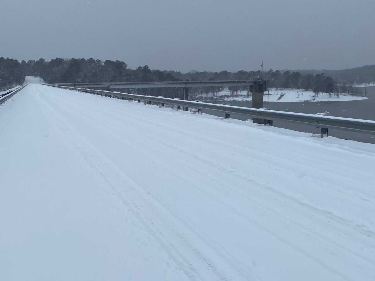
...Conditions to Deteriorate as Winter Storm Approaches...

.A significant winter storm producing a mix of snow, sleet, and
freezing rain to threaten the region today and not totally ending
until during the day Thursday. Wintry precipitation is expected
to be primarily snow along and north of Interstate 30, a mix of
snow, sleet and freezing rain around the Interstate 20 corridor,
and primarily freezing rain over Deep East Texas and Central
Louisiana. Power outages will be a risk in all areas, but
especially where freezing rain will be predominant. Of course
travel remains difficult in most of the region and any recent
improvement will be lost once this new event sets in. Temperatures
will not be nearly as cold as the last 24 hours, but will remain
well below normal.

...WINTER STORM WARNING REMAINS IN EFFECT UNTIL NOON CST
THURSDAY...

* WHAT...Heavy mixed precipitation expected. Total snow
  accumulations of up to 6 inches across southwest Arkansas and
  ice accumulations of around one half of an inch south of I-20.

* WHERE...Portions of north central and northwest Louisiana,
  southeast Oklahoma, south central and southwest Arkansas and
  east and northeast Texas.

* WHEN...Until noon CST Thursday.

* IMPACTS...Power outages and tree damage are likely due to the
  ice. Travel could be nearly impossible. The hazardous
  conditions could impact the morning or evening commute.

PRECAUTIONARY/PREPAREDNESS ACTIONS...

If you must travel, keep an extra flashlight, food, and water in
your vehicle in case of an emergency.

The latest road conditions for the state you are calling from can
be obtained by calling 5 1 1.

Today

Snow. High near 28. Wind chill values as low as 10. East wind around 5 mph. Chance of precipitation is 80%. Total daytime snow accumulation of 2 to 4 inches possible.

Tonight

A slight chance of snow, mixing with sleet after 9pm, then gradually ending. Cloudy, with a low around 22. Northeast wind around 5 mph. Chance of precipitation is 20%.

Thursday

Mostly cloudy, with a high near 32. North wind 5 to 10 mph.

Thursday Night

Partly cloudy, with a low around 10. North wind around 5 mph.

Friday

Sunny, with a high near 37. Calm wind becoming southwest around 5 mph in the afternoon.

Friday Night

Partly cloudy, with a low around 17.

Saturday

Mostly sunny, with a high near 44.

Saturday Night

Mostly cloudy, with a low around 33.

Sunday

A 20 percent chance of showers after noon. Mostly cloudy, with a high near 50.

Sunday Night

A 20 percent chance of showers before midnight. Partly cloudy, with a low around 29.

Monday

Sunny, with a high near 56.

Monday Night

Mostly clear, with a low around 31.

Tuesday

Sunny, with a high near 61.

UA Cossatot - All Campuses Will Be Closed Through the Rest of the Week; Another Winter Storm on the Way

“Due to the continuing dangerous road conditions in the area and the possibility of another extended winter storm all UA Cossatot campuses will be closed for the rest of this week (Wednesday, February 16th, Thursday, February 17th, and Friday, February 18th). UA Cossatot fully expects to be open under normal hours on Monday, February 22nd.”

Dr. Steve Cole
Chancellor
UA Cossatot

snow pic tuesday.jpg

Winter Storm Warning On The Way For Tonight Through Thursday Noon

...Next winter storm will push into our area tonight and
continue through Thursday morning...

...WINTER STORM WARNING REMAINS IN EFFECT FROM 6 PM THIS EVENING
TO NOON CST THURSDAY...
...WIND CHILL ADVISORY IS CANCELLED...

* WHAT...A wintry mix of snow, sleet, and freezing rain. Snow and
  sleet accumulations will range from less than 2 inches south of
  the I-20 corridor to 5 to 8 inches north of the I-30 corridor.
  Ice accumulations of a quarter of an inch to a half of an inch
  with localized higher amounts will be possible from Deep East
  Texas across northwestern Louisiana, central Louisiana, and into
  south- central Arkansas.

* WHERE...Portions of north central and northwest Louisiana,
  southeast Oklahoma, south central and southwest Arkansas and
  east and northeast Texas.

* WHEN...From 6 PM this evening to noon CST Thursday.

* IMPACTS...Treacherous road conditions will continue across the
  region. Locations with over a quarter inch of ice will see
  downed limbs and powerlines which will lead to the possibility
  of widespread power outages. Cold temperatures will continue to
  make extended time outdoors dangerous with the risk of
  hypothermia.

PRECAUTIONARY/PREPAREDNESS ACTIONS...

If you must travel, keep an extra flashlight, food, and water in
your vehicle in case of an emergency.

The latest road conditions for the state you are calling from can
be obtained by calling 5 1 1.

Tonight

Snow, mainly after 9pm. Low around 18. Wind chill values as low as 10. Southeast wind around 5 mph. Chance of precipitation is 80%. New snow accumulation of 1 to 3 inches possible.

Wednesday

Snow before noon, then snow, freezing rain, and sleet. High near 28. Wind chill values as low as 9. Northeast wind around 5 mph. Chance of precipitation is 90%. Little or no ice accumulation expected. New snow and sleet accumulation of 3 to 5 inches possible.

Wednesday Night

A slight chance of snow showers and freezing rain before midnight. Cloudy, with a low around 21. Northeast wind around 5 mph. Chance of precipitation is 20%.

Thursday

Mostly cloudy, with a high near 37. North wind 5 to 10 mph.

Thursday Night

Partly cloudy, with a low around 11.

Friday

Sunny, with a high near 38.

Friday Night

Partly cloudy, with a low around 17.

Saturday

Mostly sunny, with a high near 44.

Saturday Night

Mostly cloudy, with a low around 33.

Sunday

A 30 percent chance of showers. Mostly cloudy, with a high near 52.

Sunday Night

A 30 percent chance of showers. Mostly cloudy, with a low around 32.

Monday

Mostly sunny, with a high near 57.

Hard Freeze for Tonight and More Snow Expected in Forecast from the National Weather Service

...HARD FREEZE WARNING REMAINS IN EFFECT UNTIL 6 AM CST TUESDAY...

* WHAT...Sub-freezing temperatures to fall into the single digits
  tonight.

* WHERE...Portions of north central and northwest Louisiana, south
  central and southwest Arkansas, and portions of east Texas.

* WHEN...Through 6 AM CST Tuesday.

* IMPACTS...Hard freeze conditions will kill crops, other
  sensitive vegetation and damage unprotected outdoor plumbing.

PRECAUTIONARY/PREPAREDNESS ACTIONS...

Take steps now to protect tender plants from the cold. To prevent
freezing and possible bursting of outdoor water pipes they should
be wrapped, drained, or allowed to drip slowly. Those that have
in-ground sprinkler systems should drain them and cover above-
ground pipes to protect them from freezing.

Tonight

Partly cloudy, with a low around 1. Northwest wind around 5 mph becoming calm in the evening.

Tuesday

Increasing clouds, with a high near 26. Wind chill values as low as 1. Calm wind becoming southeast around 5 mph in the afternoon.

Tuesday Night

A chance of snow showers before midnight, then snow and sleet likely. Cloudy, with a low around 19. Wind chill values as low as 11. East wind around 5 mph. Chance of precipitation is 70%.

Wednesday

Snow showers before noon, then snow showers, freezing rain, and sleet. The snow could be heavy at times. High near 29. Northeast wind 5 to 10 mph. Chance of precipitation is 100%.

Wednesday Night

Snow showers, freezing rain, and sleet likely before midnight, then a chance of snow showers. Cloudy, with a low around 23. Chance of precipitation is 60%.

Thursday

A 40 percent chance of snow showers, mainly before noon. Mostly cloudy, with a high near 33.

Thursday Night

Partly cloudy, with a low around 10.

Friday

Sunny, with a high near 38.

Friday Night

Partly cloudy, with a low around 18.

Saturday

Mostly sunny, with a high near 46.

Saturday Night

Mostly cloudy, with a low around 35.

Sunday

Mostly cloudy, with a high near 53.

UA Cossatot Campuses Will Be Closed Again Tuesday Because of Winter Weather and Hazardous Road Conditions

“Due to the extremely dangerous road conditions all UA Cossatot campuses will be closed on Tuesday, February 16th. We will continue to watch the next winter storm expected to arrive late Tuesday, Wednesday, and Thursday as this may warrant more closures later in the week.”

Dr. Steve Cole
Chancellor
UA Cossatot

Photo of De Queen Lake Road Above Spillway Monday Morning - by Jon Bunyard

Photo of De Queen Lake Road Above Spillway Monday Morning - by Jon Bunyard